Cliff Erosion monitoring survey
North Norfolk District Council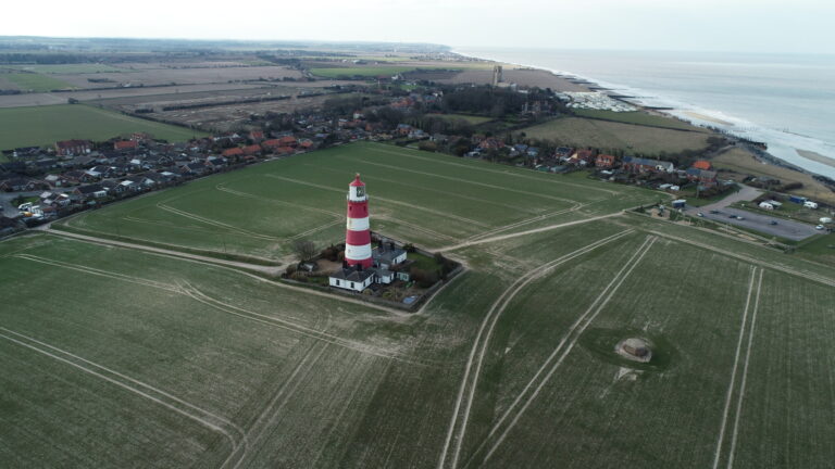
Services
- Monitoring Survey
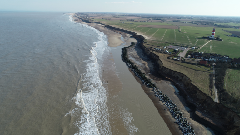
"Cliff retreat affects a wide community area and has major human, social, economic and environmental impact. Our involvement has helped to counter this through monitoring cliff realignment and evaluating the impact of climate change on the north Norfolk Coast; it has helped to inform and shape coastal management planning in north Norfolk"
CESAR HOYOS FRANCOLAND SURVEYORASSOCRICS GEOMATICS

- Name
CESAR HOYOS FRANCO
SENIOR LAND SURVEYORBA (Hons), GIS Specialist- Telephone
- 07512 193310
- Cesar.Hoyos@nps.co.uk
- View Biography
"Cliff retreat affects a wide community area and has major human, social, economic and environmental impact. Our involvement has helped to counter this through monitoring cliff realignment and evaluating the impact of climate change on the north Norfolk Coast; it has helped to inform and shape coastal management planning in north Norfolk"
Project Summary
In addition to producing repeatable, comparable and more accurate data, Norse Consulting’s use of high-tech drone technology has dramatically reduced time on site and reduced risk to surveyors.
Traditional surveying methods require the positioning of equipment within 2m of cliff edges. Within locations with extreme danger of land collapse, even when managed, this carried risk to team members and resulted in less accuracy. To measure manually, the surveyor had to walk next to the cliff, following a slightly different path each time. The drone, however, flies autonomously, following the same predefined flight path each time to provide homogenous data.
Previous results were also only able to deliver a 2D clifftop line; now, 3D measurements are possible.
The data generated by the team has helped North Norfolk District Council to take remedial engineering work, including repositioning the protective rock embankment and redesigning the position of the new ramp. Worth more than £10,000 to date, the project has also resulted in cost savings.
Before Norse Consulting introduced drone technology, it could take a surveying team most of a day to capture data over a 1500m stretch of cliff. Now, the same stretch can be measured in just 36 minutes of flight time.
Project Overview
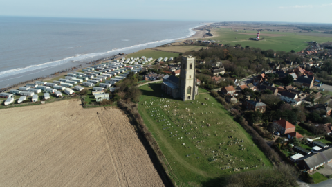
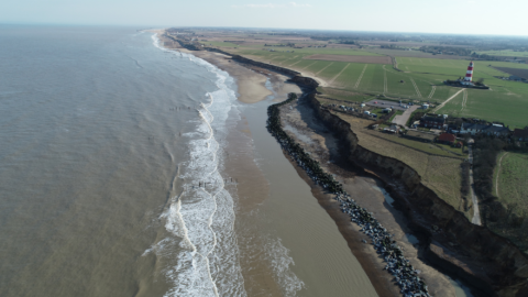
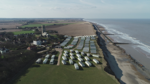
Using pioneering drone technology, Norse Consulting has been monitoring coastal erosion in a village in north Norfolk since 2018.
This village was once more than 250m from the sea and prior to the construction of a protective rock embankment in 2015, at least one house was lost every year, together with agricultural land. Overall, between 1998 and 2015, the UK spent more than £2 billion to protect its coasts from flooding and erosion.
Commended in the RTPI Awards for Planning Excellence – Excellence in Tech Within. Planning for its work, the Geomatics team produces high level photogrammetry and thermal imaging using drones.
Two team members are now Civil Aviation Authority (CAA) licenced drone pilots, able to undertake three independent, 12-minute flights, obtaining more than 760 images at a height of 100m above the ground. Outputs generated include Point Cloud, Orthophoto, Digital Elevation Model and Digital Surface Model files, enabling 2D and 3D measurements, volumetric calculations and sections.
Related Projects
![]()
Projects ![]()
Projects Carrowbreck Meadow
Find out more![]()
Projects Cliff Erosion monitoring survey
Find out more
